What do Geologic Maps tell us?
Geologic maps show the distribution of bedrock and unconsolidated sediments using colors, lines, and symbols. These maps contain an explanation that describes the composition, texture, and age of the rocks. Geologic maps may be accompanied by one or more geologic cross-sections, showing the bedrock relationships in the subsurface. The locations of important features such as folds and faults are also shown on geologic maps.
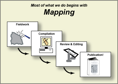
Schematic of the Mapping process
Geologic maps provide basic information for land development and conservation projects. Large projects (dams, roads, bridges, and buildings) require detailed geological analysis because of monetary, health, and safety concerns. Smaller projects, such as waste disposal systems and water wells also benefit from an understanding of the local geology. Geologic maps are also used for:
- Evaluation of geologic hazards (landslides, earthquakes, land subsidence)
- Planning transportation and utility routes
- Site selection for public facilities (landfills, waste-treatment facilities, waste-disposal sites, schools)
- Land-use planning and evaluation of land-use proposals
- Regulatory decisions
- Environmental assessment and protection planning (underground storage tanks, landfills, aquifer contamination)
- Development and protection of groundwater
- Natural-resource assessment, exploration, development, and management
- Basic earth-science research
Where can I find Geologic Maps of Virginia?
We have a team of geologists working on geologic mapping in Virginia. The maps we produce will enhance Virginia's ability to develop and conserve natural resources in a safe and environmentally sound manner to support a more productive economy. Each year we have map deliverables showing our progress. Visit the links below to view our maps.
What is STATEMAP?
The National Geologic Mapping Act of 1992 established the National Cooperative Geologic Mapping Program to implement and coordinate an expanded geologic mapping effort by the U.S. Geological Survey, the state geological surveys, and universities. The primary goal of the STATEMAP program is to collect, process, analyze, translate, and disseminate earth-science information through geologic maps. In Virginia, priorities for the program are cooperatively developed through a Geologic Mapping Advisory Committee.
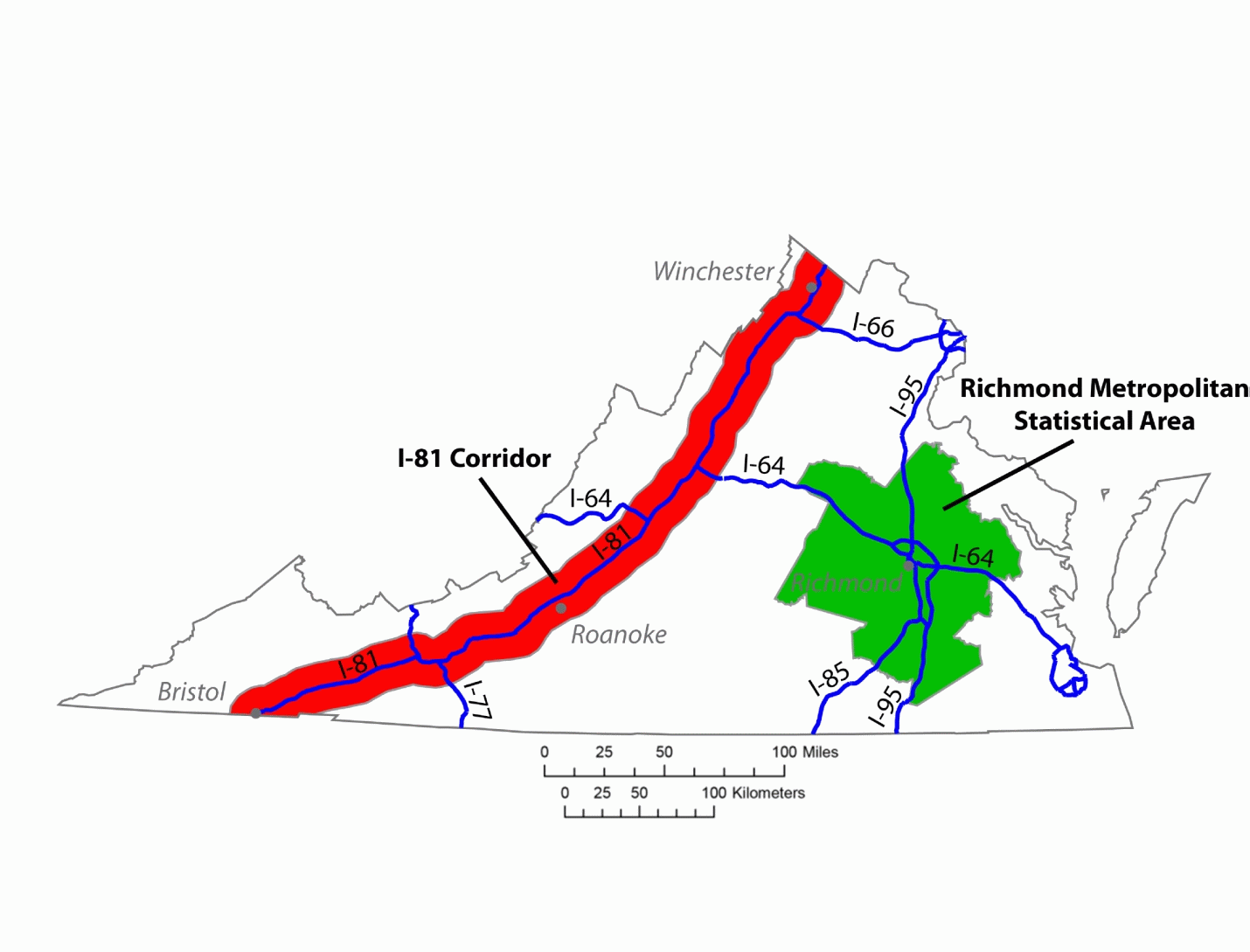
Where are we mapping?
Geology and Mineral Resources completes geologic mapping in accordance with a STATEMAP proposal that is developed each year with input from an advisory committee. The Virginia STATEMAP proposal details the work we plan to complete in the upcoming year.
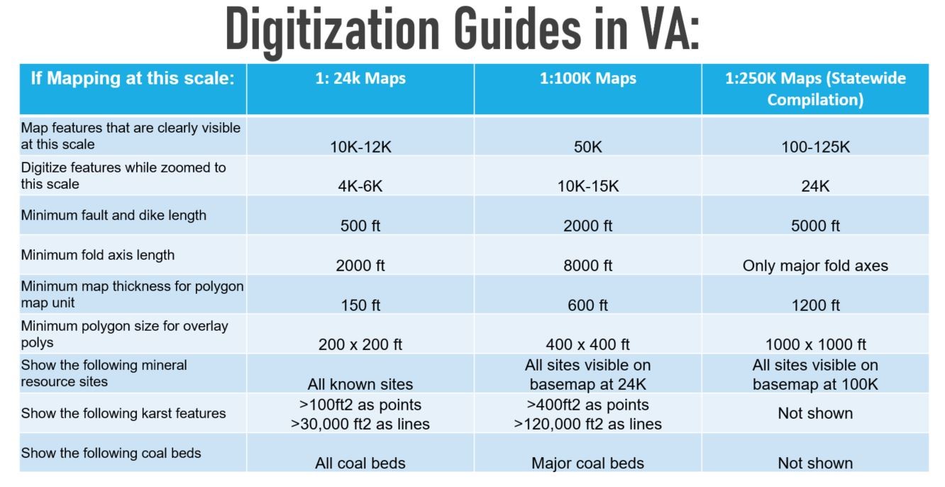
What are some of the tools we use for geologic mapping?
Our mapping geologists use LiDAR to accurately map geologic landforms like river terraces and sand dunes. LiDAR, which stands for Light Detection and Ranging, is a method of remote sensing that uses lasers to measure the distance between two objects. Precise, three-dimensional models of the Earth's surface can be generated from these measurements. LiDAR allows our geologists to examine and map both natural and manmade features in fine detail.
Find out more about how our geologists turn field work into a map here »
What is the Geologic Map Schema (GeMS)? How do we apply the GeMS standard to our maps?
GeMS (Geologic Map Schema) is a new standardized database design for the digital publication of geologic maps. It is intended to bridge the gap between traditional geologic mapping and GIS communities by providing a digital form of the content contained in individual geologic maps published by the U.S. Geological Survey and by state geological surveys. The design is focused on the publication, transfer, and archiving of map data and less on the creation of map data, the visual representation of map data, or the compilation of data from many different map sources.
In the interest of achieving a standard process and product for our map deliverables, our geologists have produced a few documents and best practices.
Our GeMS Glossary
One of the features of the GeMS standard is a glossary of terms used in map databases. In most cases, the American Geosciences Institute (AGI) Glossary of Geology definitions are used, but we have found it necessary to develop a glossary of terms either defined by our staff or modified from other sources. This list is not a complete GeMS glossary and will be updated as we find terms that need to be added from our new mapping and conversion of old maps.
Access our GeMS glossary here »
Virginia Department of Energy © 2024