
|
Your Price: $0.00
Model
Number: 3128
|
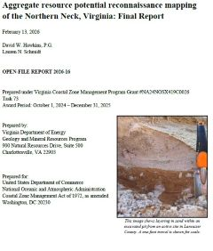
By Hawkins, D.W. and Schmidt, L.N., 2026, 33 p., 1 Plate, and 4 appendices. The Virginia Department of Energy’s (Virginia Energy) Geology and Mineral Resources Program prepared a sand and gravel deposit potential map and geodatabase for the Northern Neck Planning District in Virginia. This one-year project was funded in part by the Virginia Coastal Zone Management (CZM) Program through a grant provided by the U.S. National Oceanic and Atmospheric Administration (NOAA). This second phase of work follows a proof-of-concept study of aggregate resource potential across the Middle Peninsula region (Hawkins and Schmidt, 2025). The Northern Neck Planning District encompasses almost 480,000 acres, with approximately 1,370 miles of shoreline along the Chesapeake Bay, Rappahannock River, and Potomac River. Sand and gravel are the primary aggregate resources in the region and are essential for construction, roadway maintenance, and coastal resilience projects such as shoreline protection. Sand and gravel aggregate production in the Commonwealth of Virginia was valued at $156 million in 2024, with $4.2 million contributed from the Northern Neck Planning District counties (Virginia Energy, 2025). Virginia Energy staff conducted a multiparameter analysis of aggregate resource potential using ArcGIS software by integrating various geologic datasets including geologic borehole logs, mine site commodity data, 1-meter lidar, sediment textural data, soil survey data, and the national wetland inventory data. Staff characterized overburden and mineable deposit materials from active sites across the Northern Neck Planning District and incorporated new grain size and geochemical data into the analysis. This report includes a geodatabase, which contains the unique datasets used for this characterization. The analysis was completed by converting geologic and soil data to overlay raster datasets and then using the cell statistics geoprocessing tool to create a cumulative sum raster. The final output raster was classified into four quantiles ranging from higher potential to unlikely potential for sand and gravel deposits. The Pleistocene Windsor and Tabb Formations were ranked higher than other geologic units for sand and gravel potential. The Pleistocene Bacons Castle and Shirley Formations, and Pliocene sections of the Chesapeake Group demonstrated potential for mineable deposits. This report describes the methods used to create the map and database and provides the authors’ assessments of resource potential. End users can incorporate the geospatial data into a geographic information system (GIS) based platform to better understand where potential sand, gravel, or clay resources may occur that can support resilience initiatives such as shoreline protection, habitat restoration, infrastructure upgrades, and road maintenance. Zip file. On-line only.
|
|