HyperLink
Sign In Sign In Sign Out Logout Account Account Cart Cart
 
  SEARCH    Help?         Why do we use cookies?       Privacy Policy/Disclaimer
    Home

Product Categories


Sales & Returns Policy


Spacer Image

Spacer Image
Spacer ImageOpen File Report 08-07 Geologic Map of a Portion of the Chatham Hill Quadrangle, Virginia
Spacer Image Spacer Image
Spacer Image
Spacer ImageYour Price: $0.00
Spacer ImageModel Number: 3034

Spacer Image
Spacer Image
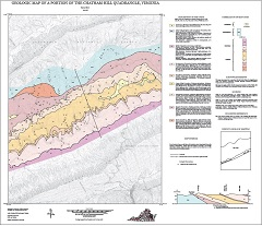
By S. Bier, 29 x 32-inch color 1:24,000-scale geologic map, 2000. This map of a portion of the Chatham Hill 7.5-minute quadrangle in Smyth and Tazewell counties, Virginia shows the distribution of Paleozoic-age sedimentary rocks in map and cross-section. Alluvium is also shown. Online only.
Spacer Image