HyperLink
Sign In Sign In Sign Out Logout Account Account Cart Cart
 
  SEARCH    Help?         Why do we use cookies?       Privacy Policy/Disclaimer
    Home

Product Categories


Sales & Returns Policy


Spacer Image

Spacer Image
Spacer ImageUSGS GQ-1119: Geologic map of the Whitesburg quadrangle, Kentucky-Virginia and part of the Flat Gap quadrangle, Letcher County, Kentucky
Spacer Image Spacer Image
Spacer ImageIn Stock
Spacer ImageYour Price: $9.00
Spacer ImageModel Number: 977

Spacer Image
Spacer Image
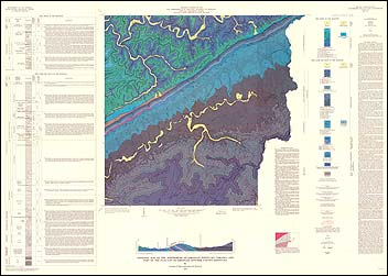
by C. R. Meissner, color map with text, one sheet, scale 1:24,000, 1973. This map shows the bedrock geology of the Whitesburg 7.5-minute quadrangle and part of the Flat Gap quadrangle and includes the area’s stratigraphy and structure. Map includes a cross-section.
 Customers who bought this also bought
  Wytheville, VA-NC-TN Topographic Map (1:100,000)
  Geologic Map Of Virginia (1:500,000)
  Holston Valley, TN-VA Topographic Map (1:24,000)
  Wyndale, VA Topographic Map (1:24,000)
  Caney Ridge, VA Topographic Map (1:24,000)
 
Spacer Image