
|
Report of Investigations 028: Geology of Newport News South and Bowers Hill quadrangles, Virginia
|
|
|
In Stock
Your Price: $6.00
Model
Number: 1196

|
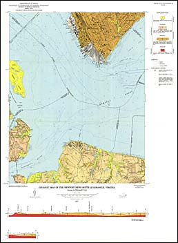
by N.K. Coch, 26 pages, 2 maps in color, 7 figures, 1 table, 1971. Map shows the geology of the Newport News South and Bowers Hill 7.5-minute quadrangles. These quadrangles are located in the Outer Coastal Plain. They include portions of Isle of Wight County and portions of the cities of Chesapeake, Hampton, Portsmouth, and Newport News. Exposed sediments range from late Miocene to Recent and consist of Miocene Yorktown Formation, the Pleistocene Norfolk and Sand Bridge Formations, and the Holocene Dismal Swamp peat and estuarine sediments. Map includes cross-sections.
|
|
|
|
Customers who bought this also bought
|
Report of Investigations 017: Geology of the Benns Church, Smithfield, Windsor, and Chuckatuck quadrangles, Virginia
|
Report of Investigations 030: Geology of the Yorktown, Poquoson West, and Poquoson East Quadrangles, Virginia
|
Publication 009: Geology of the Norfolk South quadrangle, Virginia
|
Report of Investigations 018: Geology of the Williamsburg, Hog Island, and Bacons Castle Quadrangles, Virginia
|
Bulletin 083: Geologic Studies, Coastal Plain of Virginia
|
|
|
|
|
|
|
|
|